 Commonwealth Numbered Acts
 Commonwealth Numbered Acts
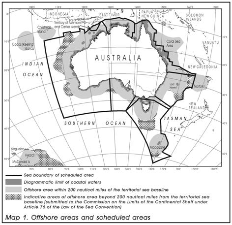
(1) This section sets out simplified maps illustrating areas off the coast of Australia that are relevant to this Act.
(2) In the interests of simplification:
(a) coastlines and boundaries have been smoothed; and
(b) the maps do not show certain waters within the limits of a State or Territory; and
(c) the line marking the outer limits of the coastal waters of a State or Territory appears to be further out to sea than it actually is.
Map 1
(3) Map 1 illustrates the offshore areas and the scheduled areas:

Note 1: As at the day on which the Bill that became this Act was introduced into the House of Representatives, certain maritime areas adjacent to Australia remained subject to delimitation with other countries. The full extent of Australia’s claimed exclusive economic zone and continental shelf jurisdiction has not been shown in this map. The claimed jurisdiction extends beyond the areas shown in this map.
Note 2: Generally, the territorial sea baseline is the line of lowest astronomical tide along the coast, but it also encompasses straight lines across bays (bay closing lines), rivers (river closing lines) and between islands, as well as along heavily indented areas of coastline (straight baselines) under certain circumstances.
Note 3: The location of the Joint Petroleum Development Area established under the Timor Sea Treaty is indicated on this map as the unshaded space abutting the offshore areas of Western Australia and the Northern Territory. The Joint Petroleum Development Area is not included in any offshore area as defined by this Act.
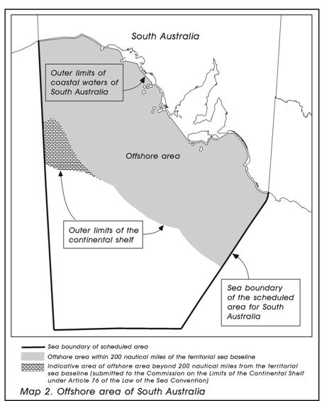
Map 2
(4) Map 2 zooms in and illustrates the offshore area of South Australia:

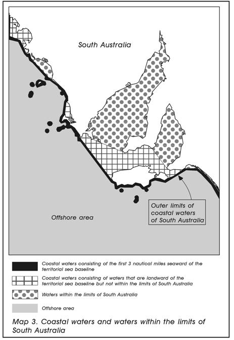
Map 3
(5) Map 3 zooms in and illustrates coastal waters and waters within the limits of South Australia:

Note: The bays shown as being within the limits of South Australia are for illustrative purposes only.